Mapas

Taxonomía

Código

Nota(s) sobre el alcance

  • Refers to graphic or photogrammetric representations of the Earth's surface or a part of it, including physical features and political boundaries, where each point corresponds to a geographical or celestial position according to a definite scale or projection. The term may also refer to similar depictions of other planets, suns, other heavenly bodies, or areas of the heavens. Maps are typically depicted on a flat medium, such as on paper, a wall, or a computer screen. For similar depictions on a sphere, see "globes (cartographic spheres)."

Nota(s) sobre el origen

  • AAT

Mostrar nota(s)

Términos jerárquicos

Mapas

Términos equivalentes

Mapas

Términos asociados

Mapas

47 Descripción archivística resultados para Mapas

45 resultados directamente relacionados Excluir términos relacionados

Purdy, Helen C. Map collection

  • ASM0235
  • Colección
  • 1700-1800

The late Helen C. Purdy, professor emeritus and former head of the Archives and Special Collections Department, donated a variety of library materials following her retirement in 1991. This collection consists of maps of Florida and the West Indies.

Andre Rodgers papers

  • ASM0370
  • Colección
  • 1918-1941

A typescript by Rudi Franke in which he narrates the journey to France of a German infantry during World War II. The document also includes photographs, maps and hand drawn sketches.

Sin título

Mark F. Boyd collection

  • ASM0037
  • Colección
  • 1493-1953

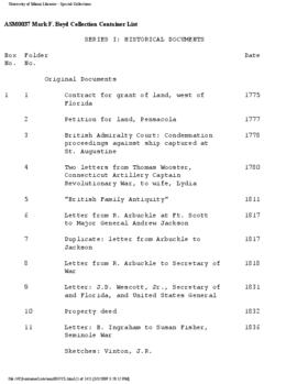
The Mark F. Boyd Collection contains materials relating to Florida and United States history as well as to natural history and medicine.  The collection, arranged in six series, includes maps, newspapers, prints, photographs, pamphlets, original documents, copies of historical documents, reprints of articles and other materials.

Sin título

Phanor James Eder papers

  • ASM0062
  • Colección
  • 1644-1971

The Phanor James Eder collection consists mainly of correspondence.  The letters are from the mid 1800's to the early 1900's.  The bulk of the correspondence is addressed to Santiago M. Eder, Dr. Eder's father.  These letters are divided into local and foreign correspondence and are addressed to Santiago M. Eder by businessmen who bought or sold some sort of merchandise to  him. Most of the letters deal with the sugar mills and other farm plantations owned by Santiago Eder. Although most of the correspondence belongs to Santiago M. Eder, there is some correspondence belonging to James Eder, Phanor's son and Charles (Chaz) and Henry J. Eder, Phanor's brothers. They all had a part in the Cauca Valley Agricultural Company. In this collection we also find correspondence dealing with the Cauca Valley Agricultural Company, a sugar mill owned by the Eder family.  Just a small portion of the correspondence deals with the Eder family's personal matters.

Two microfilms, manuscripts and ledgers are included in the collection.  The film and manuscripts are agriculturally related, dealing with the land of Colombia. The ledgers are records of businesses owned by the Eders.

The Eder Collection is primarily business related, but also has material which deals with the government of Colombia and some which deals with court cases in which Santiago M. Eder was one of the lawyers involved. The collection includes brochures and pamphlets about Colombia, which describe the land and the people. They seem to be commercially oriented. There are photocopies of material belonging to the United States National Archives which deal with legal matters. Most of these photocopies belong to group 59 of the National Archives in Washington, D.C.

The collection also includes a substantial number of maps, mainly of Colombia and the Caribbean/West Indies including one from a 16th Century atlas. The maps are housed separately from the rest of the collection.

Sin título

Jay Fish papers

  • ASM0263
  • Colección
  • 1983

Jay Fish was president of the Miami Geological Society, Inc. The Jay Fish Papers consist of documents pertaining to a 1983 symposium held by the Miami Geological Society, titled "Geology of South Florida." Many of the documents are letters, typescripts, maps, photographs, and essays sent to Fish by scientists wishing to present at the symposium. However, several periodicals on geology are included as well.

Sin título

ARC 510 Map Projects

Original drawn, sketched, or drafted maps and plans for a project for the course ARC 510 Spring 1994. Topics were planning for the Miami Intermodal Center and the East/West Corridor Study. Various maps of Metropolitan Miami-Dade were created for reference on tourism, rail lines, freight transportation, transit, political districts, community boundaries, water and green spaces, public building locations, "events and destinations corridor," and general land-use maps.
Some data credited to Florida Power & Light. "Prof. Kaul" and "Prof. Valle" are mentioned. Student names include Markus A. Ketnath, Zaidi Mohd Daud, and Kristi Kenney.

Sin título

Resultados 41 a 47 de 47